 |
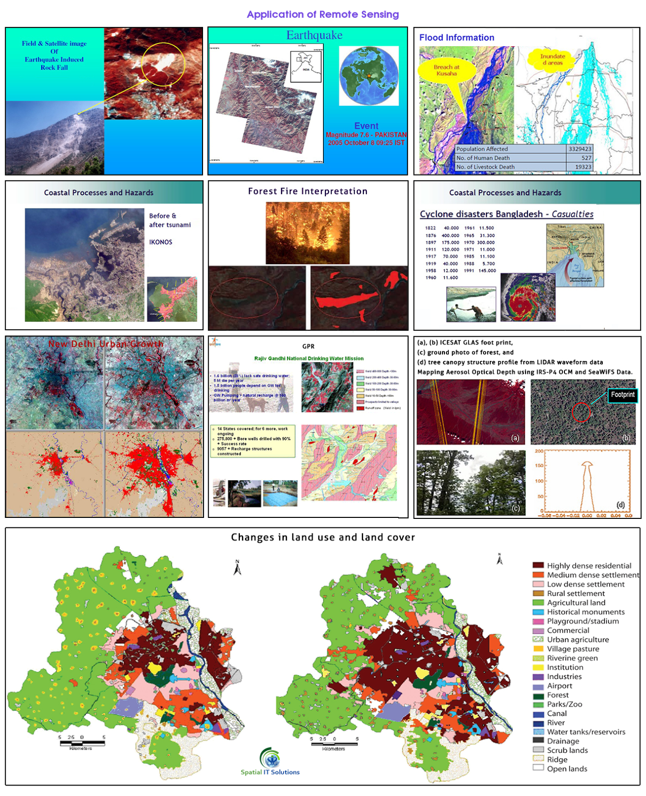
| Application of Remote Sensing |
Remote sensing is a technique to know about the various geographical features of the earth that is in the remote areas. We can know about the object or features without coming in any physical or direct contact with them and this is just because the planet earth and its environment are being observed by the number of satellites that are orbiting around the earth.
There are a large number of things being observed and covered by the satellite and all are of several fields. There are variety of remote sensing applications like climatology, oceanography, agriculture, etc. India has its own satellites Bhaskara, Rohini, Insat, IRS etc.
Some remote sensing applications are:
- Land cover and land use
- Agriculture
- Forestry
- Geology
- Geomorphology
- Hydrology
- Mapping
- Ocean and coastal monitoring
- Monitoring of Atmospheric Constituents
- Land use and land cover- Both land cover and use are different as land use is related to the various activities of human in which way they use the land for ex.-industrial, residencial, recreational etc. Whereas land cover is related to the physical state of the land ex.-forest,grassland,minerals etc.
- Agriculture-Remote sensing application in agriculture helps in identification of crops, its yield, management, condition farming etc.
- Forestry-It helps in monitoring the type of forest, its coverage, exploitation and many other ways application is helpful.
- Geology-The application in geology is helpful in knowing about the earth's crust. It provides knowledge about the landform, structure, composition by physical, chemical and biological changes on and within the surface. We come to know about deposition, bedrock, minerals, soil etc.
- Geomorphology- In geomorphology the remote sensing application tells about the landform and the process that are being used i.e. endogenetic and exogenetic processes. That includes volcanic, plate tectonic, weathering, erosion etc.
- Hydrology-This is the application that gives information about every process that is related with water for ex. water quality,soil moisture, snow,flood,lake etc.
- Mapping-Mapping is related to each and every activity that is being covered by the satellite. The remotely sensed data that are captures are shown on the maps. Through mapping we get to know about the land cover, settlements, types of crop, soil, etc.
- Oceans and coastal monitoring-Ocean application of remote sensing helps identification of the ocean and each and every activity related to oceans like shipping, oil spill, storm, currents etc.
- Monitoring of atmospheric constituent-Remote sensing application of atmospheric constituent includes water vapour,methane,carbon-di-oxide,ozone,etc.
There are endless application of remote sensing that can be used in various fields and process of land, ocean and atmosphere. There are so many applications that proved effective, whereas some are not that effective and so it is being improved by the technology.
More Info: Geospatial Consulting Services

No comments:
Post a Comment